After a
delicious lunch of grilled ham and cheese sandwiches, we left Ordaal House to
find Muness Castle, a castle on the southeast corner of the Isle of Unst, about
9 miles away from where we’re staying. This time we had a small map
specifically for the Isle of Unst, and were determined not to get lost. Even
though I’m terrible at figuring out maps, this one looked fairly basic and easy
to follow. After the main road, a left turn, another left turn, and the castle
would be at the end of a narrow, curvy road. To our great surprise, it actually
was! So many of the tourist attractions and historical sites in Scotland have
one sign on the road pointing to their general direction, and after that it’s
up to you to figure out which road to turn or not turn on. Most of the time we
haven’t found the promised historical sites and end up turning around and going
back, but this time we did find it.
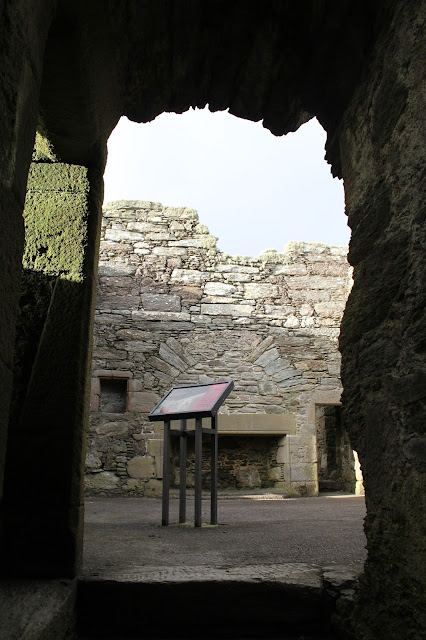
There was
the castle in front of us, standing tall and proud, though not as proud as it
once stood in 1598, the year it was built.


We got out
of our warm car and braved the fierce winds, and found a gate that lead us to
the outside area of the castle. We walked around the castle and found another
gate, and inside this gate was Muness Castle, with its door standing wide open.
We later discovered that the latch on the door was broken so it could no longer
stay shut. But we couldn’t help but think about who else might be in the
castle, as we walked through the dark hallway of the first floor and heard the
howling winds and creaking sounds and the crows cawing above us. There was no
one else in the castle but our own imaginations


.


I used the
flashlight on my phone in rooms that were too dark to see as we made our way
through the lower level of the castle. In one of the rooms, or cellars, large
decorative stones and loopholes from the castle were on display.


In one area
of the lower level was an awesome spiral staircase that is no longer in use
because the top of it, now protected by barriers, drops off. Though there is
still another staircase that can be used to reach the second story of the
castle.


The second
story is quite a contrast to the lower level because the castle no longer has a
roof and has many windows upstairs, so the sunlight made every detail of the
second story perfectly visible.

I’m confused even now as I recall the various rooms of the castle, because there were so many. There are two hallways off the main upstairs area that lead to chambers, and one of the chambers contains the remains of a private staircase.


I’m confused even now as I recall the various rooms of the castle, because there were so many. There are two hallways off the main upstairs area that lead to chambers, and one of the chambers contains the remains of a private staircase.


Muness
Castle, designed by Andrew Crawford and built by Laurence Bruce, was burned by
French raiders in 1627, and though it is believed to have been repaired, by the
end of the 1600s the castle was no longer used. The Dutch East India Company
rented the castle in 1713, and in 1718 the original owners of the castle sold
it. In 1750, it was once again abandoned and never used again. It’s an amazing
site to see, especially since so much of it is still intact. My favorite was
how many nooks and crannies and doorways and windows the castle contained.


After
touring the castle, we headed out to find Sandwick Beach, a beach not too far
from the castle and clearly marked on our map. We couldn’t find it, but
on our way to what we thought was Sandwick Beach, we saw five Shetland Ponies
right near the road, and two more standing next to a barn. We slowed down since
they were so close to the road, and opened our window. Two of them literally
tried to shove their heads in our car window. It was hilarious. When they were
done inspecting our car, all five of them stood right in front of our car, just
staring at us, and eventually walked back to the barn.


Since we
couldn’t find the beach, we turned around and headed back to Ordaal House. On
our way, we saw a sign pointing to “Sandwick Sites and Viking Longhouses.”
Though it didn’t say anything about a beach, we realized how close we were to
the water and that this was just another one of Scotland’s confusing road
signs. We made our way down a long farm type road and found another sign
depicting the various historical sites you can see down by the water.


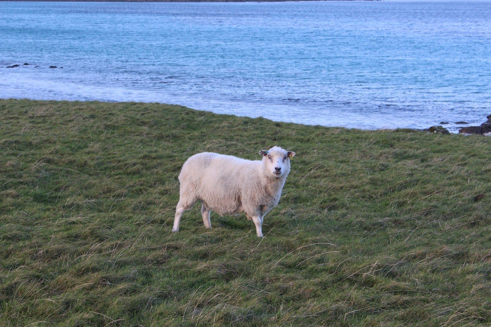
Though the
wind was bitter cold, the walk was beautiful. Fluffy sheep of many colors
surrounded us, and the water in front of us was a vivid turquoise.


We did
indeed find the crumbled remains of two different buildings, though they didn’t
have any signage so we assumed they weren’t the Norse Farm or Iron Age Building
shown on the map. Later we realized that according to the map, they must have
been those remains, and just didn’t have proper signage.


By the time we
started walking back, the sky had some pretty pink clouds in it, but also some
dark clouds straight above. It was a long walk back and we were very chilled
and out of breath once we got back to our car.

Following
the map, we found our way back to Baltasound (the town where Ordaal House is
located). Though we didn’t have the directions from our host on how to get to
their house, since we had already driven their once and assumed we could easily
find our way back the second day, we turned on what we thought was the correct
road. It wasn’t. The next road wasn’t correct either, nor the next. We
continued to drive around in circles for about an hour. When you don’t have
WiFi or a GPS that works properly and all the buildings around you look the
same, it’s easy to get lost. Finally, we gave up and parked in the
post office parking lot. My Mom walked into the post office and asked if they
possibly knew where Ordaal House was located. She was relieved to find that
they did, and the lady informed her that the map we were using was junk. It was
great to know we weren’t that horrible at reading maps. We had been going the
wrong direction around the bay the whole time. Needless to say, we were so glad
when we finally reached Ordaal House.


No comments:
Post a Comment